South Head Heritage Trail

45 mins
1.7 km Circuit

64 m
Easy track
(0km) Camp Cove car park → Camp Cove Beach

50 m
1 mins
0m
-4m
Easy track
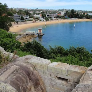
From the signposted ‘Camp Cove Car Park[1], this walk follows the ‘No Through Road’ sign[2] to the end of ‘Cliff St’. The footpath leads past a ‘Camp Cove timeline’ information sign[3] then, at the end of the road, turns left, coming to the front of the kiosk[4] at the northern end of Camp Cove Beach[5].
Camp Cove
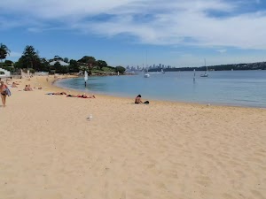
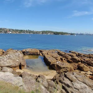
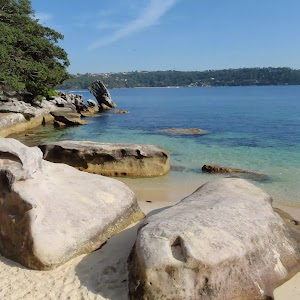
Camp Cove is home to a lovely, yellow sand, north-east facing beach. The cove is on the protected side of South Head and is a popular spot for swimming and relaxing on the beach. At the northern end of the beach is a kiosk[6], toilet block[7] and an entrance to Sydney Harbour National Park[8].
The cove was an important location to the Cadigal (Gadigal) people who gathered fresh water, shellfish, launched their canoes and buried some of their people nearby.
This cove is also believed to be the first landing place for Europeans in 1788. The name Camp Cove was given during that landing and appears on the earliest maps of Sydney Harbour[11].
(0.05km) Camp Cove Beach → Cannon

130 m
3 mins
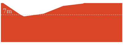
7m
-3m
Easy track
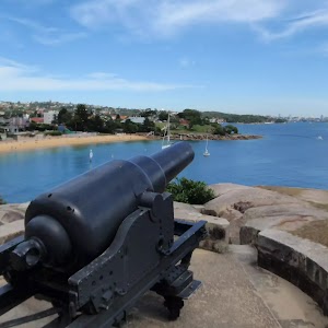
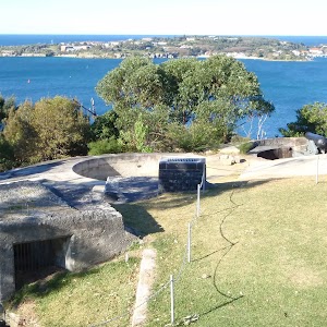
Veer right: From the front of Camp Cove Beach kiosk[12], this walk crosses the beach (keeping the water to your left)[13] and climbs up the timber staircase[14]. From the intersection at the top of the stairs, this walk continues straight, along the timber boardwalk[15] that soon turns into a concrete path. The path soon comes to a wide, cobbled sandstone path[16] that leads up a disused cannon[17], gun emplacement and great harbour views[18].
Cannon
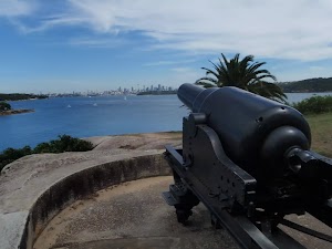
This cannon was placed here prior to 1890, along with the rest of this gun emplacement and rifle walls. The emplacement was designed to protect a military jetty and boat shed from the threat of an invasion. The ‘Cobblestone Road’ beside the cannon was built during the late 1870s or early 1880s and extends from the jetty in Camp Cove up to Hornby Road above. The road was build to carry supplies and ordnance from Camp Cove to the various military installations on south head. More info.
(0.18km) Cannon → Lady Bay Beach Int

290 m
6 mins
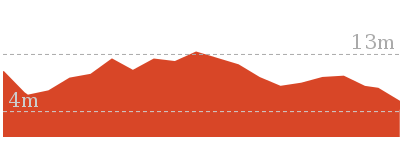
9m
-12m
Easy track
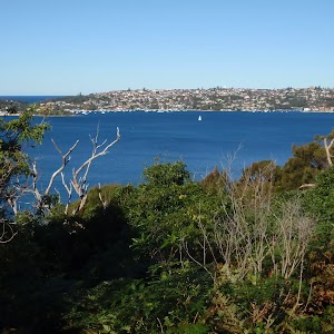
Continue straight: From the cannon, this walk heads up the path and steps and soon turns left to follow the old road[21]. The walk follows the old road, enjoying sweeping harbour views[22] (to your left). About 170m along this road (as it bends right), it passes a toilet block[23] then finds some garbage bins[24] at the end of the road. Here, the walk heads along the narrower footpath for ≈60m until coming to the signposted intersection above ‘Lady Bay Beach’[25].
(0.47km) Lady Bay Beach Int → Lady Bay Beach

30 m
1 mins
0m
-3m
Moderate track
Lady Bay Beach
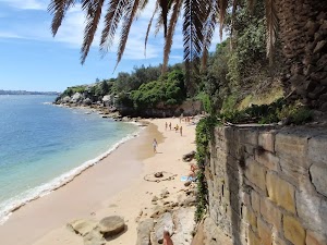
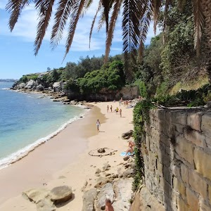
Lady Bay Beach is an official nudist beach found on the inside of South Head. Facing west, this beach is surrounded by a long cliff and a rocky shoreline[28][29]. There are great views across the water to Middle Head[30]. Officially declared a nude bathing beach by Neville Wran in 1976, nudity is only permitted on the beach and water. The beach is also known as ‘Lady Jane Beach’. You are welcome to use the beach clothed or unclad. More info.
(0.47km) Lady Bay Beach Int → Lady Bay Lookout

90 m
2 mins
5m
-2m
Easy track
Continue straight: From the intersection, this walk heads gently downhill along the main path, keeping the large fence to your right[33]. The path leads down a few steps[34] and after ≈80m, heads up a few steps[35] then some more steps through a cleft in the rock[36] to find the fenced timber lookout platform looking over Lady Bay[37].
Lady Bay Lookout
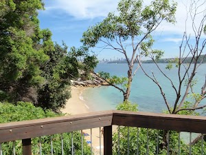
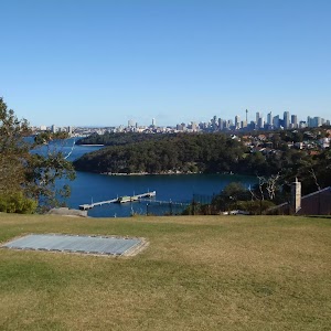
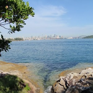
Some may find it strange having a lookout platform overlooking a nudist beach, but the harbour and city views are great[38]. This fenced and timber-decked lookout platform is found on the main walking track at the northern end of the bay. The lookout’s main view is south-west along the beach and harbour towards North Sydney. There are a few trees growing up over the view, which adds further interest to the outlook.
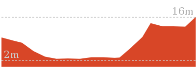
(0.62km) Circuit intersection → Lightkeepers Cottage

170 m
3 mins
3m
-10m
Very easy
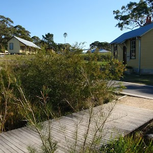
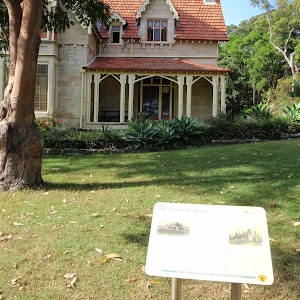
Veer left: From the intersection, this walk heads along the short section of timber boardwalk, past the ‘South Head Heritage Trail’ sign[41], keeping the filtered water views to your left[42]. The walk then follows the flat footpath through the heath and after ≈70m, the path leads to a large clearing with great views across the water[43]. The walk continues along this path, bending to the right[44] in front of the old Lightkeeper’s cottage[45] and find a ‘Lightkeeper’s Cottages 1858’ sign [46] between the old house and a gun emplacement[47].
Lightkeepers Cottage
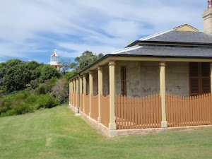
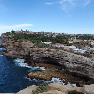
Two homes were built on South Head for the Hornby lighthouse keepers. The first cottage is the Head Lighthouse Keeper’s Cottage in the clearing, with the assistant’s house being closer to the lighthouse. This arrangement is unusual – normally, the head keeper’s house would be closer. The head lightkeeper’s house was completed about three years after the other house, around 1860. The first head lighthouse keeper was the well-motivated James Johnston, who was aboard the Dubar (a sailing ship on route from England) that smashed against the rocks near The Gap in 1857. 121 souls were lost that evening and James Johnston was the only survivor[49]. More info.
(0.79km) Lightkeepers Cottage → Hornby Lighthouse

90 m
2 mins
4m
-1m
Easy track
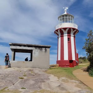
Continue straight: From the Lightkeepers Cottage, this walk heads along the footpath[50] across the small bridge[51], keeping the water views to your left. The path leads up and around to the right, past the concrete gun emplacement[52] to find the large red and white Hornby Lighthouse[53] and some great views.
Hornby Lighthouse
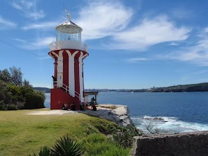
Opened by Sir William Denison (then Governor of New South Wales) in 1858, this distinct red and white vertical striped lighthouse was originally powered by a high-tech kerosene lantern. The lighthouse was built in response to two significant losses of life near South Head – firstly in 1857, the ‘Dubar’ (on it last leg from England), when 121 of the 122 people on board lost their lives, and soon after, the ‘Catherine Adamson’ when 21 lives were lost near North Head just two months later.
Since 1933, this lighthouse has been automated and is now powered with a 12 volt, 55 watt Quartz Halogen Lamp (similar to a down light in a kitchen). More info.
(0.88km) Hornby Lighthouse → Gun Emplacements

70 m
2 mins
7m
0m
Very easy
Gun Emplacements
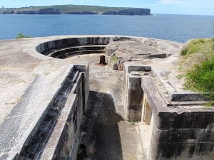
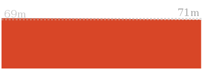
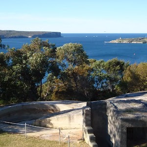
Gun emplacements like these have been built up and down the coast, and around the shores of Sydney Harbour. The first emplacement, built in 1788, was designed as a signalling station to notify the arrival of a ship. Then in 1839, the undetected arrival of ships, from the fast developing USA, caused a great concern. This triggered the building of the well-known fortifications at Bradleys Head and Fort Denison, as well as these ones at South Head. Another enemy at the time, France, then joined a campaign against a newer enemy – the Russians – in 1853, which prompted the completion of these gun emplacements. Guns were installed in 1872. In WWII, it was a Japanese enemy who these guns were trying to keep out, then in 1944, when the threat of invasion was less of a concern, the emplacements where disarmed[61]. More info.
(0.95km) Gun Emplacements → Camp Cove car park

750 m
16 mins
24m
-32m
Easy track
Continue straight: From the Gun Emplacements and ‘Fortifications 1854’[62] sign, this walk heads uphill along the footpath, away from the lighthouse. The path passes the second fortification[63] then an overgrown third fortification[64] as the path bends to the right [65]. The path then heads down and crosses the old road[66], following the path down the hill and soon comes to timber boardwalk, a four-way intersection and a large ‘South Head Heritage Trail’ sign[67] on your right.
Turn left: From the intersection, this walk heads directly away from the face of the ‘South Head Heritage Trail’ sign[68] along the timber boardwalk[69] and down a series of steps. The timber boardwalk soon leads to a fenced lookout with a view over Lady Bay[70].
Continue straight: From Lady Bay Lookout, this walk heads down the steps[71] next to the lookout and follows the footpath alongside the large fence[72]. The path heads up a series of steps to the signposted intersection above ‘Lady Bay Beach’[73].
Continue straight: From the intersection, this walk heads gently uphill along the footpath (keeping the water to the right) and after ≈60m, the path comes to the end of an old road. This walk continues along the old road, past the garage bins[74] and the large toilet block (on your left)[75]. The walk now follows the road as it leads around a sweeping left-hand bend, enjoying more harbour views until turning right onto a footpath, near a palm tree (just before the road meets a large fence). The walk heads down this path and some steps to find a disused cannon[76], gun emplacement and more great harbour views[77].
Continue straight: From the cannon, this walk heads down along the wide, cobbled sandstone path[78] (keeping the water views to your right). The walk then follows the footpath gently downhill to an intersection[79][80] (with a toilet block on the left). The walk heads straight, then down the steps and across the beach to the front of the Camp Cove Beach Kiosk[81].
Veer left: From the northern end of Camp Cove Beach, this walk heads up the concrete path next to the kiosk[82] to find the end of Cliff St. The walk follows the road past the ‘Camp Cove timeline’ information sign[83] to an intersection with Victoria St and the signposted ‘Camp Cove Car Park[84].
Maps for the South Head Heritage Trail walk
You can download the PDF for this walk to print a map.These maps below cover the walk and the wider area around the walk, they are worth carrying for safety reasons.
| Sydney Heads | 1:25 000 Map Series | 91302N SYDNEY HEADS | NSW-91302N |
| Sydney | 1:100 000 Map Series | 9130 SYDNEY | 9130 |
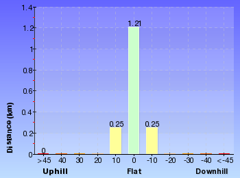
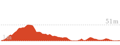
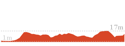
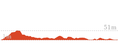
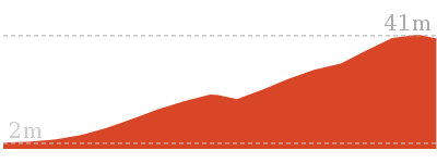
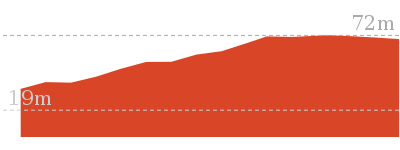
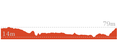
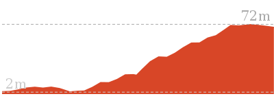
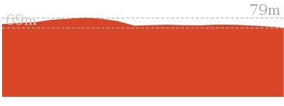
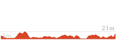
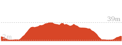
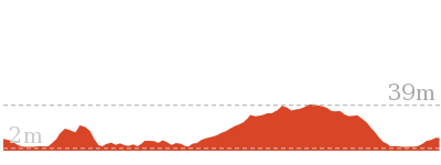
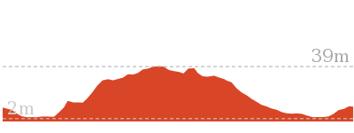
Cross sectional view of the South Head Heritage Trail bushwalking track

Analysis and summary of the altitude variation on the South Head Heritage Trail
Overview of this walks grade – based on the AS 2156.1 – 2001
Under this standard, a walk is graded based on the most difficult section of the walk.
| Length | 1.7 km | ||
| Time | 45 mins | ||
| . | |||
| Grade 2/6 Easy track |
AS 2156.1 | Gradient | Gentle hills with occasional steps (2/6) |
| Quality of track | Clear and well formed track or trail (2/6) | ||
| Signs | Clearly signposted (1/6) | ||
| Experience Required | No experience required (1/6) | ||
| Weather | Weather generally has little impact on safety (1/6) | ||
| Infrastructure | Generally useful facilities (such as fenced cliffs and seats) (1/6) |
Some more details of this walks Grading
Here is a bit more details explaining grading looking at sections of the walk
Gradient
Around 1.4km of this walk has gentle hills with occasional steps, whilst the remaining 350m is flat with no steps.
Quality of track
Around 1.6km of this walk follows a smooth and hardened path, whilst the remaining 110m follows a clear and well formed track or trail.
Signs
This whole walk, 1.7km is clearly signposted.
Experience Required
This whole walk, 1.7km requires no previous bushwalking experience.
weather
This whole walk, 1.7km is not usually affected by severe weather events (that would unexpectedly impact safety and navigation).
Infrastructure
This whole walk, 1.7km is close to useful facilities (such as fenced cliffs and seats).
Similar walks
Other Nearby walks
Plan your trip to and from the walk here
The South Head Heritage Trail walk starts and ends at the Camp Cove car park (gps: -33.83939, 151.27997)Your transport options to Camp Cove car park are by;
(get details)
Fire Danger
Each park may have its own fire ban, this rating is only valid for today and is based on information from the RFS Please check the RFS Website for more information.Weather Forest
This walk starts in the Metropolitan weather district always check the formal BOM forecast or pdf before starting your walk.Forecast snapshot
Park Information & Alerts
Short URL = http://wild.tl/shht
Gallery images
There are other downloads I am still working on.
You will probably need to login to access these — still all free.
* KML (google earth file)
* GPX (GPS file)
Special Maps/ brochures
* A3 topo maps
* PDF with Lands Topo map base
* PDF with arial image (and map overlay)
I wanted to get the main site live first, this extra stuff will come in time.
Happy walking
Matt 🙂





Comments