History of Nielsen Park

20 mins
896 m Return

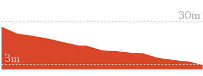
25 m
Easy track
(0km) Greycliffe Ave Car Park → Nielsen Park Cafe

200 m
3 mins
0m
-7m
Very easy
From the lower end of the car park on Greycliffe Ave, this walk heads around the gate and along the sealed path (driveway) towards the water, passing the ‘Sydney Harbour National Park’ sign[1]. After ≈50m, the path leads to a four-way intersection just past the garbage bins.
Continue straight: From the intersection, this walk heads towards the water following the wide path[2]. The path soon bends left (near the toilet block, on the right[3]) and heads behind the beach, past the large information sign[4]. Soon the path heads over the ‘Dressing Pavilion’ tunnel[5] and, ≈50m later, comes to the front of the Nielsen Park Cafe[6] with it’s great water views[7].
Continue straight: From the intersection, this walk heads towards the water following the wide path[2]. The path soon bends left (near the toilet block, on the right[3]) and heads behind the beach, past the large information sign[4]. Soon the path heads over the ‘Dressing Pavilion’ tunnel[5] and, ≈50m later, comes to the front of the Nielsen Park Cafe[6] with it’s great water views[7].
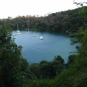
Shark Bay
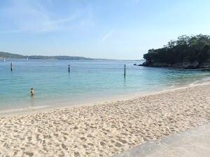
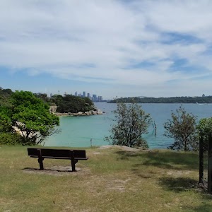
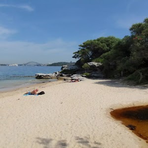
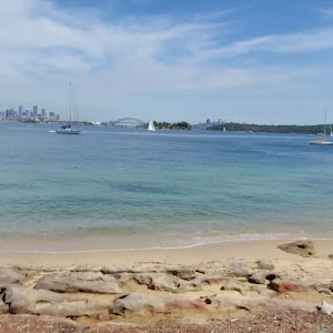
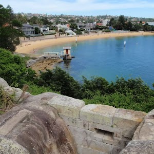
Located at the northern end of Nielsen Park, this beach faces north across Sydney Harbour. The sandy beach offers a swimming net enclosure[8], public toilets[9][10] and change rooms[11], showers[12] and is a popular place for people to simply relax. The beach is a focal point of Nielsen Park and also boasts a cafe[13]. Protected by the harbour, there is no surf at this beach. The beach is not patrolled. This is a lovely spot, with natural shade not far from the beach.
Nielsen Park Cafe
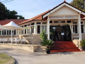
Open 8-5 daily, this historic cafe offers inside seating and a range of meals, including breakfast, sandwiches and hot food. This is one of a number of buildings in Nielsen Park which are available for functions. For further enquiries, contact 9337 1574. More info.
(0.2km) Nielsen Park Cafe → Western end of Shark Bay

90 m
1 mins
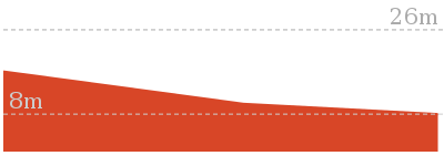
1m
0m
Very easy
Continue straight: From Nielsen Park Cafe, this walk heads the short distance along the path in front of the cafe and behind the beach (keeping the water to your right)[14]. The path heads past the ‘William Albert Notting’[15] and ‘Niels R.W. Nielsen, MLA’[16] memorial[17] (on your left) to soon find a four-way intersection (at the base of some steps) at the eastern end of Shark Bay[18].
(0.28km) Western end of Shark Bay → Degaussing range

70 m
2 mins
11m
0m
Easy track
Continue straight: From the intersection, this walk follows the ‘Hermitage Foreshore Walking Track’ sign[19] up the stairs. The path soon flattens out though the open grassy area, and heads up a few more steps to come to an intersection with a road (driveway) next to the fenced degaussing range (on your right)[20].
Degaussing range
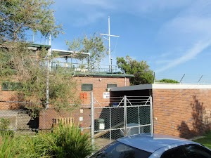
This degaussing range, found at Steele Point, was constructed in 1960 and is still operated by the Royal Australian Navy today. Degaussing is the process of removing (or at least reducing) a magnetic field. This degaussing range services four areas in the harbour (about 500m from the building), where metal ships passing over will be automatically de-magnetised. Why? Mostly to prevent the triggering of seabed mines. More info.
(0.35km) Degaussing range → Steele Point Gun Emplacement

50 m
1 mins
0m
-7m
Easy track
Turn sharp right: From the intersection, this walk heads up the driveway, keeping the degaussing range fence just to your left[24]. At the end of the driveway, the walk heads across the grass[25] to find the Steele Point Gun Emplacement[26] just behind the degaussing range. Beware of the unfenced drop into the emplacement[27]. At the end of this side trip, retrace your steps back to the main walk then Turn left.
Steele Point Gun Emplacement

Construction of this initial emplacement took about three years and was completed in 1874. The sandstone pit once had a steel dome (to protect from shells) and was part of a series of gun emplacements protecting from the threat of invasion. Today, you will find a series of tall sandstone channels[29] and the circular pit where the main gun once stood[30]. A set of un-railed steps leads into the pit – please take care in the area, as the pit is not fenced.
(0.35km) Degaussing range → Greycliffe House

100 m
2 mins
4m
-2m
Very easy
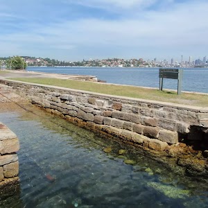
Turn left: From the degaussing range, this walk follows the ‘Greycliffe House’ sign[31] along the road (driveway), following the tall hedge. The road soon leads past a small car park[32] and then bends right, entering into the grounds of Greycliffe House[33]. Just past the small sandstone wall[34], the road comes to a four-way intersection (with some steps on the right and an information sign on the left)[35].
Greycliffe House
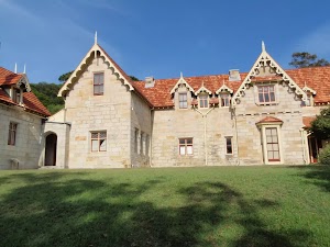
Greycliffe House was completed in 1851 by John Reeve, son-in-law to the explorer W C Wentworth. The house was unoccupied between 1898 and 1911, when it was taken over by the State Government and used as a baby hospital and Tresillian mothercraft home in to the 1930s. Many of the plantings are from this era. Today, the building is home to the Sydney Harbour South office of the NSW National Parks and Wildlife Service, and is one of few remaining examples of gothic architecture in Sydney. More info.
(0.45km) Greycliffe House → Western end of Shark Bay

90 m
3 mins
0m
-13m
Easy track
Turn left : From the intersection (in front of Greycliffe House[37]), this walk follows the path past the ‘Greycliffe House’ information sign[38] (with the house on your right). The path almost immediately bends left and heads down the steps towards the water and beach. Near the bottom, the path heads past the sandstone toilet block[39] (on your left) and comes to a four-way intersection at the eastern end of Shark Bay. Now Turn left to rejoin the main walk .
Maps for the History of Nielsen Park walk
You can download the PDF for this walk to print a map.These maps below cover the walk and the wider area around the walk, they are worth carrying for safety reasons.
| Sydney Heads | 1:25 000 Map Series | 91302N SYDNEY HEADS | NSW-91302N |
| Sydney | 1:100 000 Map Series | 9130 SYDNEY | 9130 |
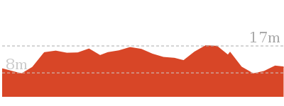
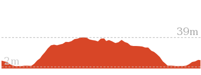
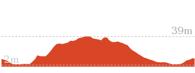
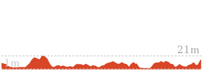
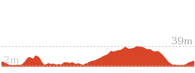
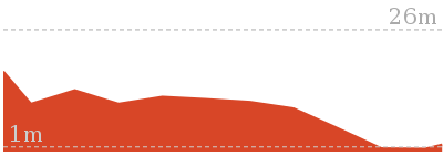
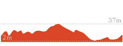
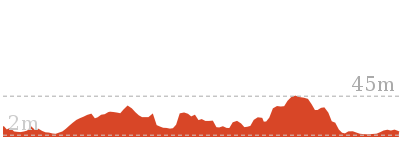
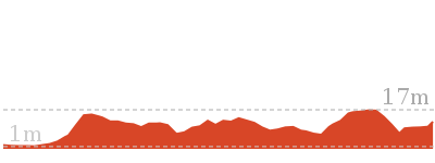
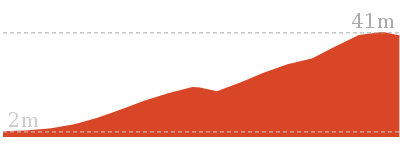
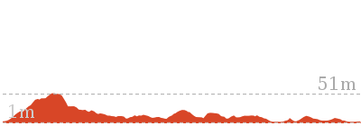
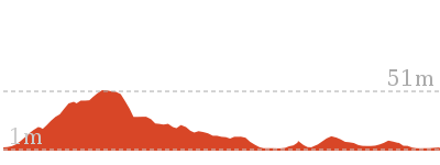
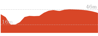
Cross sectional view of the History of Nielsen Park bushwalking track

Analysis and summary of the altitude variation on the History of Nielsen Park
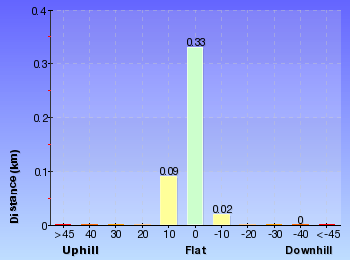
Overview of this walks grade – based on the AS 2156.1 – 2001
Under this standard, a walk is graded based on the most difficult section of the walk.
| Length | 896 m | ||
| Time | 20 mins | ||
| . | |||
| Grade 2/6 Easy track |
AS 2156.1 | Gradient | Gentle hills with occasional steps (2/6) |
| Quality of track | Smooth and hardened path (1/6) | ||
| Signs | Clearly signposted (1/6) | ||
| Experience Required | No experience required (1/6) | ||
| Weather | Weather generally has little impact on safety (1/6) | ||
| Infrastructure | Generally useful facilities (such as fenced cliffs and seats) (1/6) |
Some more details of this walks Grading
Here is a bit more details explaining grading looking at sections of the walk
Gradient
Around 380m of this walk is flat with no steps, whilst the remaining 70m has gentle hills with occasional steps.
Quality of track
This whole walk, 450m follows a smooth and hardened path.
Signs
This whole walk, 450m is clearly signposted.
Experience Required
This whole walk, 450m requires no previous bushwalking experience.
weather
This whole walk, 450m is not usually affected by severe weather events (that would unexpectedly impact safety and navigation).
Infrastructure
This whole walk, 450m is close to useful facilities (such as fenced cliffs and seats).
Similar walks
Other Nearby walks
Plan your trip to and from the walk here
The History of Nielsen Park walk starts and ends at the Greycliffe Ave Car Park (gps: -33.850846, 151.26857)Your transport options to Greycliffe Ave Car Park are by;
(get details)
Fire Danger
Each park may have its own fire ban, this rating is only valid for today and is based on information from the RFS Please check the RFS Website for more information.Weather Forest
This walk starts in the Metropolitan weather district always check the formal BOM forecast or pdf before starting your walk.Forecast snapshot
Park Information & Alerts
Short URL = http://wild.tl/honp
Gallery images
There are other downloads I am still working on.
You will probably need to login to access these — still all free.
* KML (google earth file)
* GPX (GPS file)
Special Maps/ brochures
* A3 topo maps
* PDF with Lands Topo map base
* PDF with arial image (and map overlay)
I wanted to get the main site live first, this extra stuff will come in time.
Happy walking
Matt 🙂











Comments