Fairfax Walk

30 mins
762 m Circuit

45 m
Very easy
North Head Scenic Drive car park

(0km) North Head Scenic Drive car park → Start of Fairfax track

10 m

0m
0m
Very easy
From the North Head Scenic Drive car park, this walk follows the ‘Fairfax walking track’ sign[5] across the pedestrian crossing and up the small ramp[6]. The walk leads past the ‘Welcome to North Head’ information sign[7], then between the timber bollards[8] to the intersection marked with the metal ‘Fairfax walking track’ sign[9].
(0.01km) Start of Fairfax walk → South Pacific (Eastern) Lookout

140 m
3 mins
2m
-8m
Very easy
Turn left: From the intersection, this walk heads gently uphill along the wide path, initially keeping the car park (through the heath) to the left. The path almost immediately leads past a seat (on the left) and leads gently uphill for about 30m to go over a rise then starts heading gently downhill, where the path bends right[10]. About 90m past this bend the path leads to a 3-way intersection above South Pacific (Eastern) Lookout.
(0.15km) South Pacific (Eastern) Lookout int. → South Pacific (Eastern) Lookout

10 m

0m
-1m
Very easy
Turn left: CURRENTLY CLOSED. From the intersection, this walk heads directly towards the ocean views along the asphalt path[11]. The path then comes to the top of some steps, where there are great views[12]. Continue down the stairs to come to the formal fenced lookout[13] and wonderful cliff views. At the end of this side trip, retrace your steps back to the main walk then Turn left.
South Pacific (Eastern) Lookout

From this lookout, you can enjoy great views north along the coastal cliff line and as far as the horizon across the South Pacific Ocean. With a fenced cliff edge and a nice seat, this is a great spot to sit and soak up the views. In 2017 part of this lookout was closed and fenced off due to cliff instability, you can still enjoy the view from behind the fence
(0.15km) South Pacific (Eastern) Lookout int. → Old Gun Emplacement

120 m
2 mins
1m
-3m
Very easy
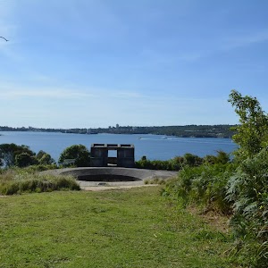
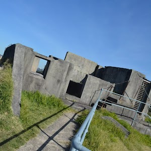
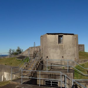
Old Gun Emplacement
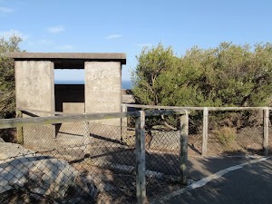
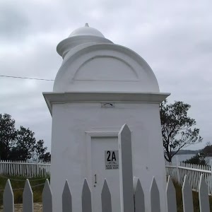
This small concrete building[17][18] was used as a gunning placement and bunker for those who would keep watch over Sydney Harbour during World War Two. It was built in the 1920s (prior to the war), one of several new fortifications built at the time, the first since federation. Access to the building is via an 82cm wide entry, up two (5cm and 15cm) steps and into a 2.4×2.1m room.
(0.27km) Old Gun Emplacement → North Head (Southern) Lookout int.

60 m
2 mins
0m
-18m
Very easy
(0.32km) North Head (Southern) Lookout int. → North Head (Southern) Lookout

20 m
1 mins
1m
-9m
Very easy
North Head (Southern) Lookout
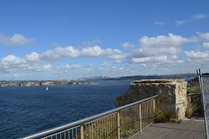
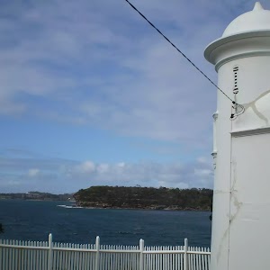
This lookout is on the southern edge of North Head and provides a great view that spans from Sydney city in the distance[24] (to the south), around the South Pacific Ocean[25] (to the east). You will notice a large white pole with a green light[26], which helps ships navigate and avoid the headland as they sail into Sydney Harbour. The lookout has a 1.18m high fence/railing around the edge.
In 2017 part of this lookout was closed and fenced off due to cliff instability, you can still enjoy the view from behind the fence[27].
(0.32km) North Head (Southern) Lookout int. → Fairfax Lookout intersection

170 m
5 mins
20m
-18m
Very easy
Turn right: From the intersection near North Head (Southern) Lookout, this walk follows the main footpath[28] gently downhill keeping the fence and ocean to the left. The path leads beside a section of nearly bald cliff top opening up wide ocean views[29] for nearly 150m to come to a 3-way intersection[30] (with the steps on track on the left).
Continue straight: From the intersection, this walk follows the footpath distinctly uphill[31], initially keeping the ocean (and step track) to the left. The path leads up the slope for 30m to come to a large 3-way intersection marked with a ‘Fairfax Lookout’ plaque[32] (on the left).
Continue straight: From the intersection, this walk follows the footpath distinctly uphill[31], initially keeping the ocean (and step track) to the left. The path leads up the slope for 30m to come to a large 3-way intersection marked with a ‘Fairfax Lookout’ plaque[32] (on the left).
(0.49km) Int of Fairfax lookout and loop track → Fairfax Lookout

50 m
2 mins
2m
-20m
Very easy
Turn left: From the intersection, this walk follows the wide footpath gently downhill[33] towards the upper Fairfax lookout area to find an intersection just before the seat[34].
Veer right: From the upper Fairfax Lookout, this walk heads gently down the ramped footpath[35] (between two metal handrails) for about 30m to come to the lower Fairfax Lookout platform[36] (with a seat on the right). At the end of this side trip, retrace your steps back to the main walk then Veer left.
Veer right: From the upper Fairfax Lookout, this walk heads gently down the ramped footpath[35] (between two metal handrails) for about 30m to come to the lower Fairfax Lookout platform[36] (with a seat on the right). At the end of this side trip, retrace your steps back to the main walk then Veer left.
Fairfax Lookout
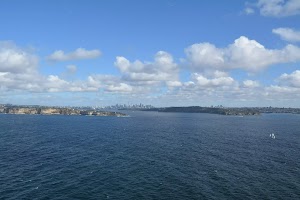
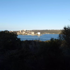
Fairfax Lookout is a great vantage point to enjoy the entrance to Sydney Harbour[37], the majestic cliff line[38] and the city skyline in the distance. It is a great reminder of how much bushland there is in the great city. This is a good vantage point for whale watching when the Humpback and Southern Right whales migrate along the coast. The whales usually head north in June-July to a warmer climate for breeding and return to the food-rich Antarctic waters in August-October, where they remain for the summer.
There is a seat at the upper and lower viewing areas. The lookout has a 1.2m high metal fence along the edge. A small section of the lower lookout was closed[39] in 2017 due to cliff instability.
(0.49km) Int of Fairfax lookout and loop track → North Head Scenic Drive car park

270 m
6 mins
22m
0m
Very easy
Veer right: From the intersection, this walk heads gently uphill along the footpath keeping the timber fence to the left[40]. The path winds gently uphill for just shy of 120m to come to an intersection with a dirt trail[41] (on the left).
Continue straight: From the intersection, this walk heads gently uphill following the asphalt footpath[42] as it winds through the heath. After 130m the path leads past a timber seat (on the right)[43] and then comes to an intersection near the car park and road (on the left)
Turn left : From the intersection, this walk heads towards the car park, between the timber bollards. The walk leads past the ‘Welcome to North Head’ information sign[44] and down the small ramp[45] to the pedestrian crossing at the North Head Scenic Drive car park.
Maps for the Fairfax Walk walk
You can download the PDF for this walk to print a map.These maps below cover the walk and the wider area around the walk, they are worth carrying for safety reasons.
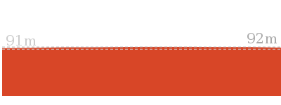
| Sydney Heads | 1:25 000 Map Series | 91302N SYDNEY HEADS | NSW-91302N |
| Sydney | 1:100 000 Map Series | 9130 SYDNEY | 9130 |
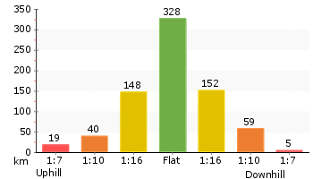
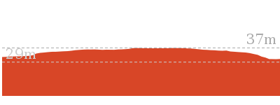
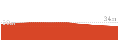
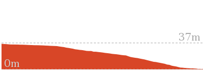
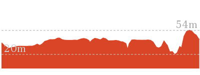
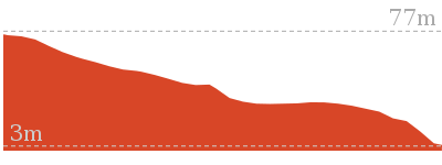
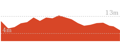
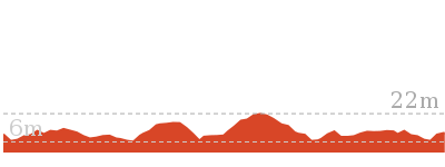
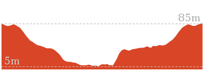
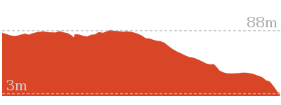
Cross sectional view of the Fairfax Walk bushwalking track

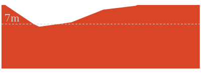
Analysis and summary of the altitude variation on the Fairfax Walk
Accessibility summary information for the Fairfax Walk
Parking: There are 1 designated accessible parking areas on this walk.
Toilets: There are 0 designated accessible toilets on this walk.
Seats: There are 2 places to sit on this walk. They are 740m apart.
Hazards: There are 0 specific noteable accessability related hazards on this walk.
Toilets: There are 0 designated accessible toilets on this walk.
Seats: There are 2 places to sit on this walk. They are 740m apart.
Hazards: There are 0 specific noteable accessability related hazards on this walk.
Accessibility Details
Overview of this walks grade – based on the AS 2156.1 – 2001
Under this standard, a walk is graded based on the most difficult section of the walk.
| Length | 762 m | ||
| Time | 30 mins | ||
| . | |||
| Grade 1/6 Very easy |
AS 2156.1 | Gradient | Flat, no steps (1/6) |
| Quality of track | Smooth and hardened path (1/6) | ||
| Signs | Clearly signposted (1/6) | ||
| Experience Required | No experience required (1/6) | ||
| Weather | Weather generally has little impact on safety (1/6) | ||
| Infrastructure | Generally useful facilities (such as fenced cliffs and seats) (1/6) |
Some more details of this walks Grading
Here is a bit more details explaining grading looking at sections of the walk
Gradient
This whole walk, 760m is flat with no steps.
Quality of track
This whole walk, 760m follows a smooth and hardened path.
Signs
This whole walk, 760m is clearly signposted.
Experience Required
This whole walk, 760m requires no previous bushwalking experience.
weather
This whole walk, 760m is not usually affected by severe weather events (that would unexpectedly impact safety and navigation).
Infrastructure
This whole walk, 760m is close to useful facilities (such as fenced cliffs and seats).
Similar walks
Other Nearby walks
Plan your trip to and from the walk here
The Fairfax Walk walk starts and ends at the North Head Scenic Drive car park (gps: -33.821232, 151.2997)Your transport options to North Head Scenic Drive car park are by;
(get details)
Fire Danger
Each park may have its own fire ban, this rating is only valid for today and is based on information from the RFS Please check the RFS Website for more information.Weather Forest
This walk starts in the Metropolitan weather district always check the formal BOM forecast or pdf before starting your walk.Forecast snapshot
Park Information & Alerts
Short URL = http://wild.tl/9i
Gallery images
There are other downloads I am still working on.
You will probably need to login to access these — still all free.
* KML (google earth file)
* GPX (GPS file)
Special Maps/ brochures
* A3 topo maps
* PDF with Lands Topo map base
* PDF with arial image (and map overlay)
I wanted to get the main site live first, this extra stuff will come in time.
Happy walking
Matt 🙂







Comments