Warriwarri Lookout

30 mins
1.5 km Return

34 m
Easy track
Honeman’s Rock picnic area
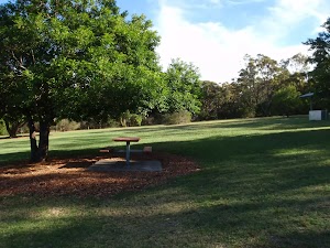
Honeman’s Rock picnic area is a large picnic area at the top end of Island View Drive. This picnic area has a couple of large grassy areas[1], composting toilets[2], free electric BBQs[3], picnic tables[4], shelters, garbage bins[5], drinking water[6] and information signs[7]. The picnic area is home to a mud brick building[8] (available for hire) and Honeman’s Rock[9], from which the area derives its name. There is a fair amount of parking available next the picnic area, and some extra spaces a few hundred meters down the road.
Honeman’s Rock
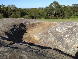
Honeman’s Rock (aka Honeyman’s Rock) is a large rock outcrop in front of the mud brick building, in the Honeman’s Rock Picnic area. The exposed section of rock is 60m long and about 30m wide, with the western side having a significant unfenced drop. The rock is named after Cecil Lyle Honeman who became a lease holder on the mountain in 1962. The rock has a large depression that once filled with water, and a drain has been dug to keep the pool empty and clear of rubbish.
Mud Brick Building

The mud brick building is a landmark in the main picnic area at Kincumber Mountain, and is a popular spot to gather. Also known as ‘Kincumber Mountain Information Centre’, ‘The Kiosk’, ‘Kincumber Kiosk’ and ‘Kincumber Mountain Kiosk’, the building was constructed in 1986 with funding from Community Employment Programme. The building is generally locked but can be booked through the local Lions Club for special events. The building has a rain water tank, small kitchen and one main large room. The verandah also provides good shelter.
(0km) Mudbrick building car park → Northern end of picnic area

180 m
3 mins
4m
-1m
Easy track
From the car park next to the mud brick building, this walk heads in front of the mud brick building and follows the path to the toilet block. Here, the walk heads across the grass between the picnic table (under the tree on the left) and the BBQ shelter (on the right) to the far end of the clearing, near another picnic table, to find the ‘Sid Pulsford Walking Trail’ sign[13].
(0.18km) Northern end of picnic area → Int of Sid Pulsford Walking and Warriwarri Lookout trails

290 m
5 mins
5m
-4m
Easy track
Continue straight: From the picnic area, this walk follows the ‘Sid Pulsford Walking Trail’ sign[14] around the locked gate and away from the clearing. The walk gently winds through the bush along the wide sandy trail, and comes to an intersection with a link track (heading up to the right) just after a large angophora.
Continue straight: From the intersection, this walk follows the wide management trail north, past the large twisted angophora, coming to the ‘Y’ intersection marked by two signs[15] (just visible from the previous intersection).
Continue straight: From the intersection, this walk follows the wide management trail north, past the large twisted angophora, coming to the ‘Y’ intersection marked by two signs[15] (just visible from the previous intersection).
(0.48km) Int of Sid Pulsford Walking and Warriwarri Lookout trails → Warriwarri Lookout

290 m
5 mins
1m
-19m
Easy track
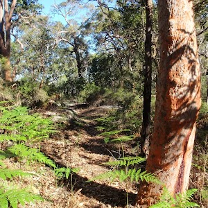
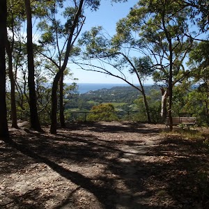
Continue straight: From the intersection, this walk follows the ‘Warriwarri Lookout’ sign[16] north along the wide sandy trail. The flat trail gently winds through the bush, passing an informal track (on the right) and soon coming to a small clearing, bench seat and signposted ‘Warriwarri Lookout’[17], which offers limited views.
Warriwarri Lookout
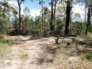
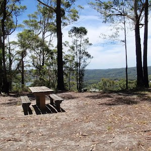
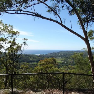
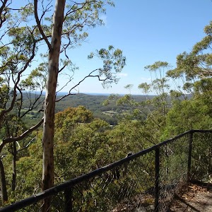
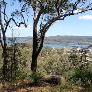
Warriwarri Lookout is an overgrown and signposted[18] lookout in the middle of Kincumber Mountain Reserve. There is a fairly large clearing and a bench seat[19]. There are slightly better views north, past the sign at the unfenced rock outcrop. The filtered views look north-east. The view from the lookout is overgrown, so do not expect much in the way of views.
Maps for the Warriwarri Lookout walk
You can download the PDF for this walk to print a map.These maps below cover the walk and the wider area around the walk, they are worth carrying for safety reasons.
| Gosford | 1:25 000 Map Series | 91312S GOSFORD | NSW-91312S |
| Gosford | 1:100 000 Map Series | 9131 GOSFORD | 9131 |
Cross sectional view of the Warriwarri Lookout bushwalking track

Analysis and summary of the altitude variation on the Warriwarri Lookout

Overview of this walks grade – based on the AS 2156.1 – 2001
Under this standard, a walk is graded based on the most difficult section of the walk.
| Length | 1.5 km | ||
| Time | 30 mins | ||
| . | |||
| Grade 2/6 Easy track |
AS 2156.1 | Gradient | Gentle hills with occasional steps (2/6) |
| Quality of track | Clear and well formed track or trail (2/6) | ||
| Signs | Clearly signposted (1/6) | ||
| Experience Required | No experience required (1/6) | ||
| Weather | Weather generally has little impact on safety (1/6) | ||
| Infrastructure | Generally useful facilities (such as fenced cliffs and seats) (1/6) |
Some more details of this walks Grading
Here is a bit more details explaining grading looking at sections of the walk
Gradient
Around 580m of this walk has gentle hills with occasional steps, whilst the remaining 180m is flat with no steps.
Quality of track
This whole walk, 770m follows a clear and well formed track or trail.
Signs
This whole walk, 770m is clearly signposted.
Experience Required
This whole walk, 770m requires no previous bushwalking experience.
weather
This whole walk, 770m is not usually affected by severe weather events (that would unexpectedly impact safety and navigation).
Infrastructure
This whole walk, 770m is close to useful facilities (such as fenced cliffs and seats).
Similar walks
Other Nearby walks
Plan your trip to and from the walk here
The Warriwarri Lookout walk starts and ends at the Mudbrick building car park (gps: -33.459138, 151.39182)Your main transport option to Mudbrick building car park is by;
(get details)
Fire Danger
Each park may have its own fire ban, this rating is only valid for today and is based on information from the RFS Please check the RFS Website for more information.Weather Forest
This walk starts in the Hunter weather district always check the formal BOM forecast or pdf before starting your walk.Forecast snapshot
Park Information & Alerts
Short URL = http://wild.tl/2e
Gallery images
There are other downloads I am still working on.
You will probably need to login to access these — still all free.
* KML (google earth file)
* GPX (GPS file)
Special Maps/ brochures
* A3 topo maps
* PDF with Lands Topo map base
* PDF with arial image (and map overlay)
I wanted to get the main site live first, this extra stuff will come in time.
Happy walking
Matt 🙂

















Comments